

Trans Missouri Trail
The "TMOT"
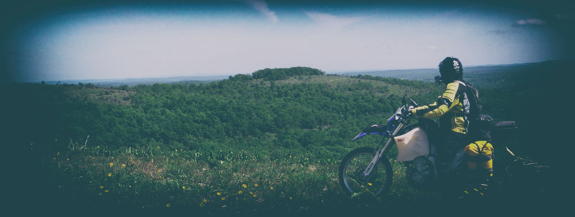
First and foremost, I am no pioneer in adventure routing nor am I a legend of the sport… I simply love to ride and contribute to the ADV community. A lot of local riders already know all the good roads, but for those who are new to the area, the goal of the TMOT is to give you a very enjoyable route through the state I live in, Missouri. We have some very good riding, especially around the Mark Twain National forest areas.. some roads are down right epic!
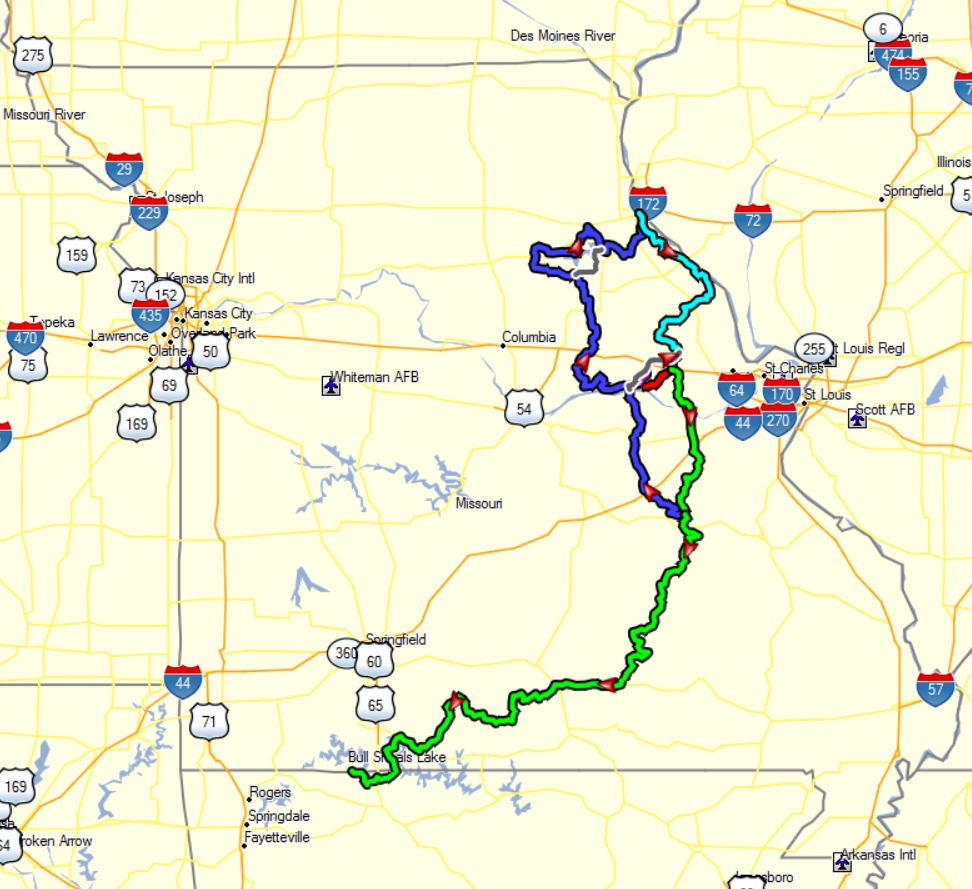
The TMOT is broken up into a few different routes, just depending on where you are coming from.. so you have plenty of options! My recommendation is to look over all of the routes, plot them out and see where you can jump on the route. Currently, my TMOT route goes from Hannibal, MO. to Blue Eye, MO. on mostly gravel, forest and creek roads. The entire route is scenic and enjoyable.. I would say it’s all big-bike friendly except one track, it’s not super technical but can be if you are a novice rider. I’ve marked it “BIG BOY” track as a optional route. This track has some deep sand, if water level’s are down then a lot of creek rock sections and if water level’s are high, use extreme caution on big bikes as the road IS THE CREEK for about 100 yards or so.
As I talked with my buddy Mark “BigDog” Sampson, he kindly offered to put a route together that would get folks to the TART from Chester, IL down to Blue Eye, MO.. this route I’ve labeled BigDog’s TMOT Route.
You’ll find plenty info below as well as GPS files. Enjoy and I’m always interested in recommendations.
Note*: There are plenty of alternative routes especially down south but I’ve chosen not to include some as they are part of other local organized rides.
2017 TMOT North Additions

As of Today….
We are currently working on routing from where our 2011 route started(see below) and continuing it north up to Iowa. There it will connect with Trans Iowa Trail!
As of the time you are reading this, I’ve routed as far north as Hannibal, Missouri on a nice scenic route, completely big bike friendly(except as noted above). There are two options heading north from Mark Twain National forest, either the western leg through Hermann, MO and around Mark Twain Lake or the eastern leg through Washington, MO.
The western leg will be more scenic and more gravel roads, where as the eastern leg has more tarmac BUT the gravel roads are very good. The main reason for the two legs is to also create a nice loop for us locals to ride! This also helps those just getting into adventure riding a good test run for their bikes and gear. There’s plenty of camping options and motels along the TMOT routes. I have not designated specific camping/sleeping locations so I’m leaving that up to you. But I’ve included a lot of campground waypoints.. do a little Google-ing and see what works best for your trip. I’m hear for any questions you may have…
TMORR
My buddy Sieg has created the Trans Missouri River Ride “TMORR”, which you can hoped on or off in Hannibal, MO. The TMORR connects the Trans Iowa Trail in Houghton, IA.
As I continue to work on TMOT routes or revisions I will be updating this page on my site. Look for videos of Day 2 Scouting North and the “Big Boy” section noted in the GPS file…
Below are the route overviews and GPS files for download. If you get out and ride these routes, PLEASE let me know how your ride was and I’d love to see some photos!
Bash3r’s TMOT North Additions
Download GPS Files
Bash3r’s TMOT Overview
Updated: August 9, 2017

Video Highlights
TMOT N : SCOUTING NORTH – Day 1
Day 1 – Scouting north from Mark Twain National Forest up through Hermann, MO, found some great scenic routes!
TMOT N : SCOUTING NORTH – Day 2
Day 2 – I continue heading north… visit the historic Union Covered Bridge, built in 1871 and explore around Mark Twain Lake.
The First TMOT South
BACK IN 2011….
In May of 2011, my buddy Aaron and I set out to create a route from the St. Charles County area down to the little small town where we met each other back in 3rd grade… this little town of Blue Eye, Missouri also happens to be where the Trans Arkansas Trail “TART” starts! What a coincidence and opportunity for us to give back to the adventure community as well as make history of our own adventure…
Read my full 2011 TMOT South Ride Report.
Bash3r’s TMOT South Route

BigDog’s TMOT Route
Download GPS Files
Video Highlights
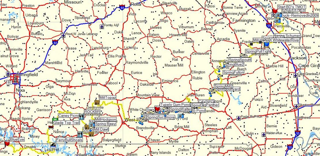
TMOT S : NEAR TOPAZ
FAST creeks almost take me down.. and we head towards the beautiful old 1800’s Topaz Mill!
TMOT S : EXPLORING TOPAZ MILL
One of the great highlights of the TMOT.. Topaz Mill!
TMOT S : GLADE TOP TRAIL
The Glade Top Trail… views looking south some 30 miles to the Boston Mountains in Arkansas.!
More to Come….
Stay tuned for more TMOT updates… I’ll be adding a video previewing the “Big Boy” sections as well as new videos of the TMOT south, I’ll be getting out and riding it again to verify the route completely.
Hope you enjoy the Trans Missouri Trail!
Campgrounds
Check out my Campground POIs for a ginormous amount of campground waypoints in the USA.